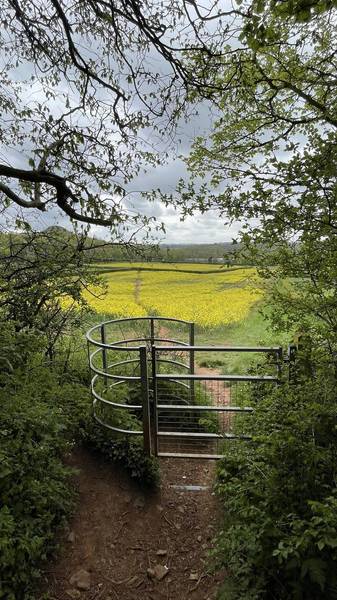
St Mary‘s and Timsbury Loop

Walks, England, Somerset, Bath and North East Somerset

Preview Steps

Download the app to get all the steps for this walk.

Map preview for St Mary‘s and Timsbury Loop
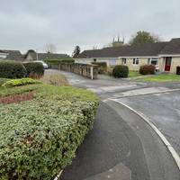
  • This walk starts at St Mary's Surgery, known also as Timsbury Surgery. The nearest bus stop is the recreation ground served by the 522.

    Step 1: This walk starts at St Mary's Surgery, known also as Timsbury Surgery. The nearest bus stop is the recreation ground served by the 522.

  • Step 2: There is an accessible toilet that can be used at the surgery during opening hours.

  • Facing the surgery entrance head right, following the pavement around to the staff car park.

    Step 3: Facing the surgery entrance head right, following the pavement around to the staff car park.

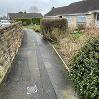
  • Cross the entrance to the car park and then turn left onto a tarmac footpath with gardens on your right.

    Step 4: Cross the entrance to the car park and then turn left onto a tarmac footpath with gardens on your right.

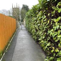
  • At the path junction, turn right and head past staggered metal barriers.

    Step 5: At the path junction, turn right and head past staggered metal barriers.

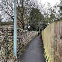
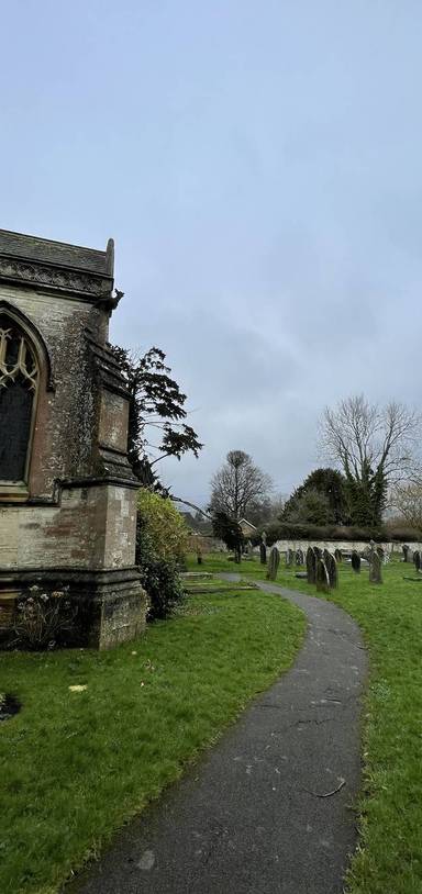
  • Continue towards the church, with the stone wall of the church grounds now to your left.

    Step 6: Continue towards the church, with the stone wall of the church grounds now to your left.

Download the app to get all the steps for this walk.

Nearby Walks

  • Preview of Timsbury Arable Circular

    Timsbury Arable Circular

    Timsbury, Bath and North East Somerset

    by theactiveway

    by theactiveway

    40 minutes / 1.7km
    An off road jaunt through arable fields and village streets. Lovely views and refreshment options en route.
    Wildlife Great views Refreshments Public transport Dog friendly Child friendly
  • Preview of Somerset Coal Canal - Walk 1

    Somerset Coal Canal - Walk 1

    Paulton, Bath and North East Somerset

    by claud

    by claud

    1hr 15m / 3.3km
    History and landscapes combine on this tranquil heritage route along the old Somerset Coal Canal. Wildlife and scenery galore.
    Wildlife Water feature Great views Public transport History Child friendly
  • Preview of Greyfield Woods & Waterfall

    Greyfield Woods & Waterfall

    Hallatrow, Bath and North East Somerset

    by samandsnooper

    by samandsnooper

    1hr 40m / 3.7km
    A circular woodland wander around Greyfield Woods near High Littleton to a wonderful waterfall and back.
    Wildlife Water feature Picnic spot Parking Hilly & steep Dog friendly
  • Preview of Paulton Memorial Park Stroll

    Paulton Memorial Park Stroll

    Paulton, Bath and North East Somerset

    by theactiveway

    by theactiveway

    10 minutes / 0.6km
    A 10 minute leg stretch around the park. Benches along the route and hard surfaces throughout.
    Wildlife Wheel friendly Great views History Dog friendly Child friendly
  • Preview of Paulton Greenspace Explorer

    Paulton Greenspace Explorer

    Paulton, Bath and North East Somerset

    by theactiveway

    by theactiveway

    55 minutes / 2.3km
    Take a stroll through the memorial park, up to the Arnhem Memorial site and through the Miners Recreation Ground. Great views en route.
    Wildlife Great views Public transport History Dog friendly Child friendly
  • Preview of Paulton Nature Connection Loop

    Paulton Nature Connection Loop

    Paulton, Bath and North East Somerset

    by theactiveway

    by theactiveway

    40 minutes / 1.3km
    Views aplenty on this walk through arable and pastoral fields from Elm Hayes Surgery. One short steep section.
    Wildlife Great views Public transport Hilly & steep Dog friendly Child friendly

Cookie consent

Using our site means you agree to the use of cookies and similar technologies.

Read more and how to disable cookies in our Privacy Policy