Grimsbury Reservoir Circular

Walks, England, Oxfordshire, Cherwell

Preview Steps

Download the app to get all the steps for this walk.

Map preview for Grimsbury Reservoir Circular
  • Step 1: This walk was created in partnership with Cherwell District Council. Enjoy over 30 walks across North Oxfordshire and experience the sights and sounds of nature as you go.

  • Welcome to this circular walk. It starts from the parking area at the northern end of Spiceball Park, off Grimsbury Green.

    Step 2: Welcome to this circular walk. It starts from the parking area at the northern end of Spiceball Park, off Grimsbury Green.

  • Step 3: You can get to the starting point by car from Middleton Road in Grimsbury and then along Daventry Road and Manor Road. The nearest postcode is OX16 3JJ. If you’re coming on foot, you can come from Spiceball Park to the south.

  • Use the vehicular exit to leave the car park, bear left and immediately right onto the road.

    Step 4: Use the vehicular exit to leave the car park, bear left and immediately right onto the road.

  • Step 5: There are no pavements, but it’s a quiet road. Still, be aware of other road users. For advice on best ways to walk in the countryside check out the read more panel below.

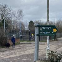
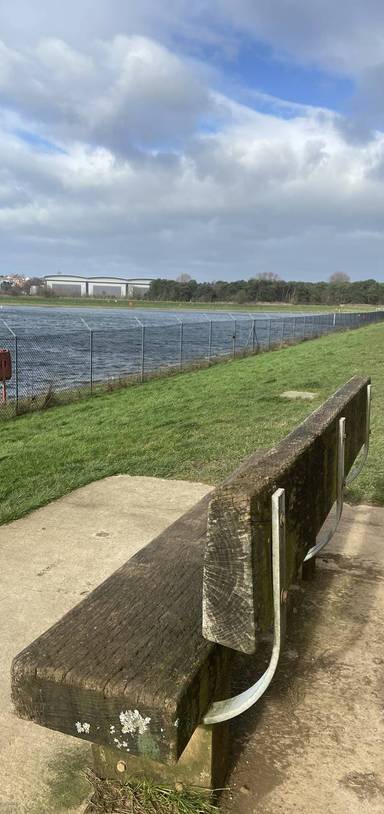
  • Turn left at the blue sign for Grimsbury Reservoir and walk down the service road.

    Step 6: Turn left at the blue sign for Grimsbury Reservoir and walk down the service road.

Download the app to get all the steps for this walk.

Nearby Walks

  • Preview of Exploring Banbury’s Spiceball Park

    Exploring Banbury’s Spiceball Park

    Banbury, Oxfordshire

    by northoxfordshirewalks

    by northoxfordshirewalks

    1 hour / 2.9km
    A short walk around Spiceball Park, featuring riverside and park views. A lovely break into nature from bustling town centre!
    Water feature Great views Public toilets Refreshments Parking Dog friendly
  • Preview of Banbury Fringe Walk Challenge

    Banbury Fringe Walk Challenge

    Banbury, Oxfordshire

    by northoxfordshirewalks

    by northoxfordshirewalks

    5hr 30m / 16.1km
    An epic circular challenge walk around the edge of Banbury, featuring gorgeous canal and countryside paths.
    Wildlife Water feature Great views Public transport Parking Botanics
  • Preview of Banbury Linear Walk - South East

    Banbury Linear Walk - South East

    Banbury, Oxfordshire

    by northoxfordshirewalks

    by northoxfordshirewalks

    1hr 45m / 4.4km
    This is a one-way route from the town centre to Bodicote along the scenic Oxford Canal, part of the longer Banbury Fringe Walk Challenge.
    Wildlife Water feature Great views Public transport Parking Botanics
  • Preview of Grimsbury Health Walk

    Grimsbury Health Walk

    Grimsbury & Moorfield Park

    by northoxfordshirewalks

    by northoxfordshirewalks

    1hr 45m / 5km
    Explore hidden woods and leafy pathways, visit Moorfield Park and pass the schools, the shops and more on the lovely Green Star Trail.
    Wheel friendly Water feature Picnic spot Dog friendly Child friendly Botanics
  • Preview of Ruscote & Bretch Hill Health Walk

    Ruscote & Bretch Hill Health Walk

    Bretch Hill, Banbury

    by northoxfordshirewalks

    by northoxfordshirewalks

    1hr 45m / 5km
    Ruscote Park, Trinity Park, Princess Diana Park, three schools, The Hill and The Sunshine Centre, this trail goes everywhere!
    Wildlife Great views Picnic spot Dog friendly Child friendly Botanics
  • Preview of Banbury Town Centre Art Walk

    Banbury Town Centre Art Walk

    Banbury, Oxfordshire

    by northoxfordshirewalks

    by northoxfordshirewalks

    1 hour / 2.2km
    Come along on this public art walk in Banbury, incorporating Castle Quay, Market Square, Parsons Street, Horsefair, Butchers Row, and more!
    Water feature Public toilets Refreshments Public transport Parking History

Cookie consent

Using our site means you agree to the use of cookies and similar technologies.

Read more and how to disable cookies in our Privacy Policy